
3D Archaeology: a drone capable of detecting and digitally recording unexcavated remains
The UAVIMALS project, halfway between archaeology and biorobotics, has been concluded; the interdisciplinary research team of Sapienza University of Rome and Scuola Superiore Sant'Anna of Pisa, designed and engineered a small-sized aerial laser scanner prototype, useful for light archaeological investigations. The project was supported by a National Geographic Society grant obtained in September 2018, with an Early Carrer Grants (EC-50761T-18) by Federica Vacatello (project leader and PhD in Archaeology - curriculum of Archaeology and Post-classical Antiquities - at the Department of Ancient World Studies of Sapienza), who assisted a research team comprising archaeologists, engineers and bio-robotic technicians.
The prototype was engineered by Stefano Roccella, Andrea Vannini, and Sirena Cascarano (Institute of BioRobotics of the Scuola Superiore Sant'Anna of Pisa) with the collaboration of Marcello Calisti of the Department of Agri-Robotics of the University of Lincoln. Francesca Romana Stasolla and Giorgia Maria Annoscia of the Department of Ancient World Studies at Sapienza University and Carlo Citter of the Department of Historical Sciences of Cultural Heritage at the University of Siena also supervised the archaeological part of the project.
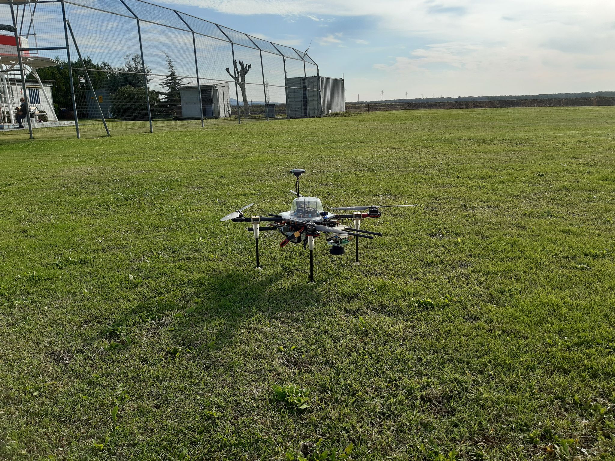
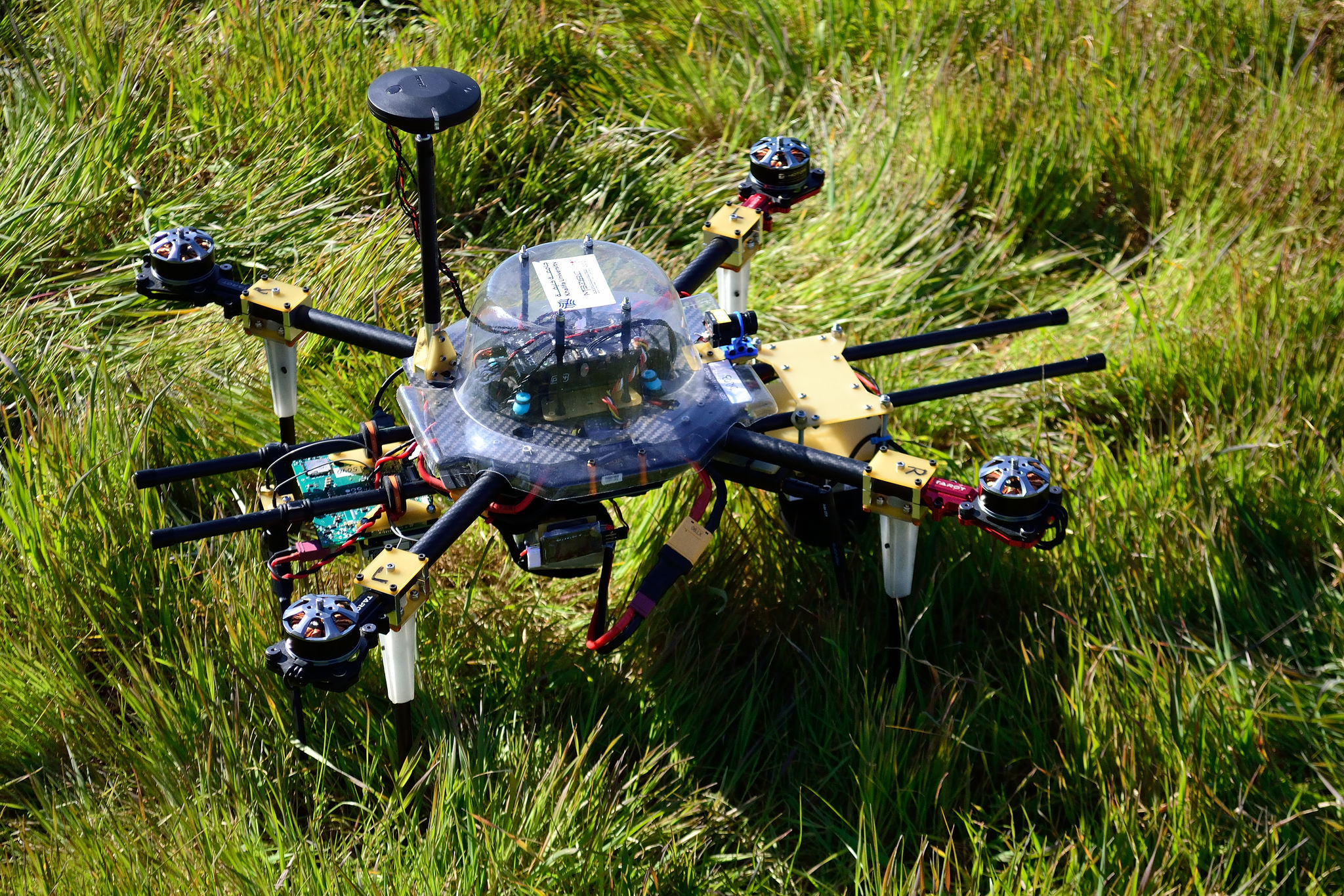
The device created is a low-cost drone, which incorporates a solid-state LIDAR sensor (i.e. a laser sensor with no moving parts) in its own control unit. While scanning the area of interest, it can measure the distance to a point on the ground being flown over, while an onboard computer saves the values acquired and synchronises them with the relevant data from the instrument's flight sensors, i.e. angles, position and altitude. The resulting records are uploaded to a laptop, and a customised app calculates the 3D coordinates of a point cloud in a matter of seconds. The cloud is then processed offline using open-source software to obtain a 3D representation of the scanned environment.
The prototype has proved to be functional for examining small and medium-sized areas not only in the archaeological field but also in the engineering, architectural and environmental fields. The ability to record the altitude of the terrain with extreme precision makes it particularly suitable for identifying anomalies in altitude that, in archaeological contexts, may indicate the presence of buried structures not yet investigated.
The innovativeness of UAVIMALS lies mainly in the type of LIDAR technology used, which makes it possible to obtain performances similar to those of instruments already widely used in the field of indirect surveying, but at a considerably lower cost and reduced expenditure of energy due to the size of the instrument, which makes it manageable and easily transportable even in places that are difficult to access.
UAVIMALS, following the first phase of laboratory experimentation, was tested on the area of the medieval city of Cencelle, an archaeological excavation that is part of the Grandi Scavi Sapienza programme under the scientific direction of Francescaromana Stasolla. Within this context, the tool scanned areas with unexcavated remains, located slightly below the surface, revealing anomalies in the ground surface elevations, which proved to coincide with two large buildings not yet identified by the archaeological investigations, but which will be the subject of research during future excavation campaigns.
The main result of the UAVIMALS project was the birth of a collaboration between the Department of Ancient World Studies and the Institute of BioRobotics of the Scuola Superiore Sant'Anna in Pisa, aimed at developing optimised flight instruments for application in territorial surveys to improve archaeological research also through the use of increasingly high-performance instruments.
Further Information
Francescaromana Stasolla
Department of Ancient World Studies
francescaromana.stasolla@uniroma1.it


